
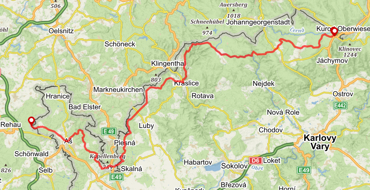
The first part of the hike starts at the beautiful westmost point of the country where you can find a spot to spend the night as well. The perfect warm-up stretch mostly runs through the border area. In Bublava, it joins the main crest of Krušné hory mountain range and takes you all the way to Boží Dar, one of the major towns there. A pleasant 100-kilometer hike helps you figure out how fit you are. This is also where you get rid of all the unnecessary stuff you packed for the trip.
You can find this section in the official app of the Czech Trail, FarOut:
View the section on mapy.cz.
View the section for the cyclists on mapy.cz

Tips for the section:
The hike passes through German territory between km 26 and km 31. If you are following the map on your mobile device, you will either need to stay online at all times, or download the map of the area beforehand. Otherwise, you will be re-routed and have to walk the long way round.
There are no ATMs between the towns of Aš and Kraslice, and there are almost no places where you can pay by card. Bring enough cash – or a banjo. You can make cash by playing it for passers-by if things get tough.
To get up-to-date information on the trail’s condition, ask other hikers on the Facebook group Stezka Českem.